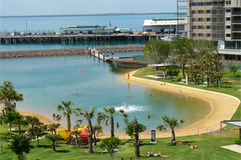
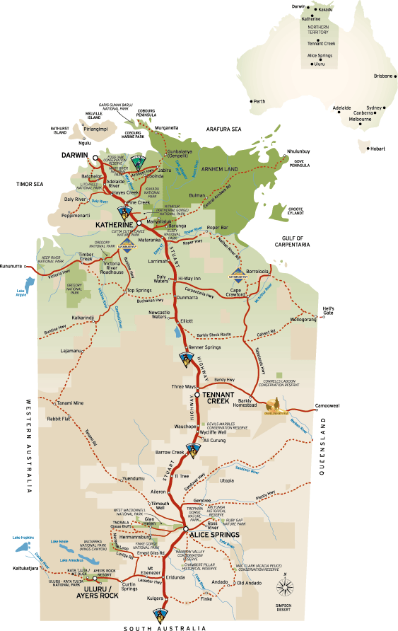
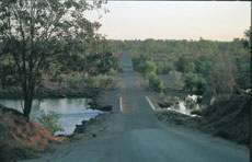
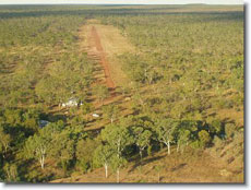
Getting to Borroloola from Darwin in Northern Territory Australia
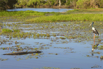
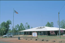
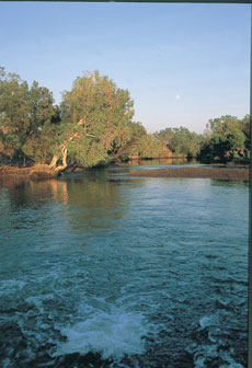
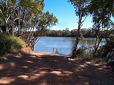
Borroloola is a relaxed and friendly remote fishing community on the McArthur River in the Gulf of Carpentaria. This historic town is considered the gateway to the Gulf region and is famed for its excellent fishing. Borroloola can be accessed via the Carpentaria Highway from Daly Waters in the Northern Territory or on the road through Garawa Aboriginal Land Trust from Queensland. Once a frontier town, Borroloola is now the capital of the Gulf region. Today, the town is still a bit wild and unruly at times, but the people are friendly and easy going.
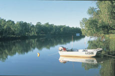
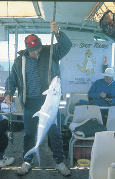
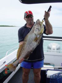
Fishing and camping remain a way of life for locals and travellers chasing barramundi. King Ash Bay, a great fishing spot 50 kilometres from Borroloola, also attracts thousands of visitors each year. The Sir Edward Pellew Group of Islands provides good reef fishing where red emperor, coral trout and parrot fish can be caught. The settlement has two main events every year. The Rodeo, Gymkhana and Campdraft held over three days in August and the Fishing Classic usually held on the Easter long weekend at King Ash Bay.
Although Borroloola belongs to the Barkly Tablelands area of the Northern Territory it's an area which, in both its vegetation and climate, is more typical of the tropical Gulf Savanna which stretches around the Gulf of Carpentaria from North Queensland.
|
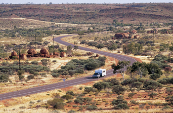
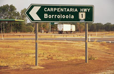
Getting to Borroloola in Northern Territory Australia Located 954 km south-east of Darwin and 380 km from the Stuart Highway, Borroloola is a smaller settlement in the Gulf of Carpentaria which sits on either side of McArthur River like two independent towns, around some 50 km from the estuary. We understand Borroloola is unusual in that it is the home of a number of Aboriginal cultures. The Yanyuwa, Mara, Karawa and Kurdanji people all live around the town. The Yanyuwa and Mara are referred to as 'saltwater people' and are associated with the Sir Edward Pellew Islands and the lower reaches of the McArthur and Wearyan Rivers . The Kurdanji and Karawa people are classed as 'mainland people' and are associated with land to the south and east of the present township. How to get there? Route 2 Route 1: Borroloola can be accessed via the Carpentaria Highway, which departs Stuart Highway at Daly Waters. It takes about 6-7 hours driving from Katherine to Borroloola. Borroloola is also accessible via all weather bitumen road from Barkly Homestead to the south and from the Hi-Way Inn for travellers heading south from Katherine / Darwin / Western Australia. Route 2: The Savannah Way Road between Borroloola and the Queensland Border is closed during the Wet Season (December - March) due to swollen river crossings. The Roper Highway (Nathan River Road section) is also closed to traffic during the wet season months when the river crossings are impassable. Airstrip The nearest main airport is in Katherine. Borroloola has a bitumen airstrip, which has a mail plane. There is a sealed all weather airstrip at McArthur River Mine, permission has to be sought from the mine liaison officer at Borroloola to utilise this strip. Note: Any unscheduled patient transport may take longer that the scheduled flight times depending on the availability, weather and the necessary inter health transfer time. Linking out: Informative report by a local business - http://www.handr.com.au/ Mataranka to Borroloola Via Roper Highway and Nathan River Road. Also we must mention Explor Oz as their site has excellent information we find: For distances we often suggest http://www.exploroz.com Scroll down to see the following information for Borooloola as services in Borroloola include: Payphones ~ Camp Grounds and Caravan Parks ~ Health Centre ~ Tourist Attractions ~ Places of Interest ~ Tourist Visitor Information ~ Fuel and Food Stops to Buy ~ 2 stores ~ Post office with Commonwealth banking agency ~ ANZ banking agency ~ School ~ Butcher ~Service stations ~ Takeaway food outlets ~ Police station. |
|
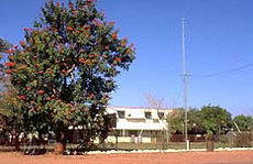
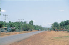
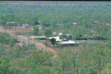
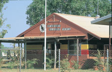
| Around Borroloola Township | |
|
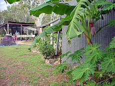
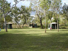
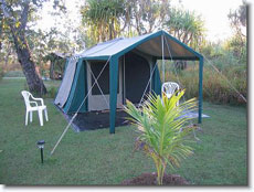
Borooloola - McArthur River Caravan Park Area: Borooloola. McArthur River Caravan Park is located 658 km south-east of Katherine on Robinson Road, Borroloola. Access is by private arrangements, tour of express coach. Local airport pick-ups can be arranged. The owner John and his son Patrick are very helful to visitors (we have experienced this first hand). Powered and unpowered van and camping sites. Self contained cabins suitable for families, budget accommodation and laundry facilities. Excellent barra fishing during February, March and April and mudcrabbing all year roound. Pets are allowed but must be restrained. The small town of Borroloola is rich in history. Learn about the lawless days of illegal activities, being tamed by our first police presence in 1886. Land of the Paperbarks is an area well known for its great river system and close proximity to the Sir Edward Pellew group of Islands. With many attractions you will find many ways to fill your days, taking in the beauty of the area and exploring the spectacular walks, parks, falls, flights and fishing. The Caranbirini Conservation Reserve is just 45 km from
us. |
 |
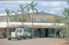
| Post Office & Supermarket
- Borroloola - Gulf Region Robinson Road, Borroloola |
 |
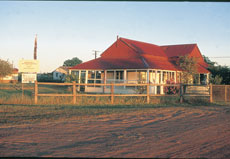
| Borroloola Hotel/Motel
Robinson Road, Borroloola Tel: +61 (0) 8 89 75 8766 Fax: +61 (0) 8 89 758 773 |
 |
| Borroloola Hotel/Inn NT
- Restaurants Robinson Road, Borroloola Tel: +61 (0) 8 89 8975 8766 |
 |
|
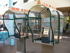
Borroloola Public Payphones 1. Chicken Shop on Robinson Road, Borroloola |
 |
| Borroloola Town Council Robinson Road, Borroloola Tel: +61 (0) 8 89 758 799 Fax: +61 (0) 8 89 758 762 |
 |
| Borroloola Guest House Robinson Road, Borroloola Tel: +61 (0) 8 89 758 883 Borroloola Aerial Services Lot 822A Borroloola Airport, Broad St, Borroloola Tel: +61 (0) 411 055 039 |
 |
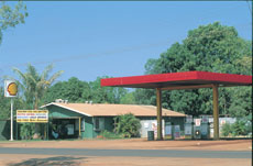
| Borroloola Mobil Services As above: Lot 822A Borroloola Airport, Broad St, Borroloola Tel: +61 (0) 411 055 039 |
|
|
Borroloola - Petrol Supplies General Information |
 |
|
Mini Mart & Service Station - Borroloola - Gulf
Region , Borroloola |
|
|
Old Police Station Museum Borroloola - Gulf Region Borroloola, Borroloola Borroloola History and Museum There are also a number of holders of keys to the museum in town including Red Dirt Trading, the McArthur River Caravan Park, Gulf Mini Mart, Terry Fisher Motors and Morgan at the H& R Holiday Unit. |
 |
|
Health Centre - Borroloola - Gulf Region The Community Health Centre, managed by the Northern Territory Government Department of Health and Community Services, provides an essential Primary Health Care service to the community. There are four nurses and six Aboriginal Health Workers on staff (as at 23 Nov 2004) to service the needs of the locals and visitors to the community. The Health Centre is located at 9 Garawa Street. Visiting Services Pharmacy GP Services in the Community Last Report we recieved Police |
 |
|
Malandari Council building - Borroloola - Gulf
Region , Borroloola Rrumburriya Malandari Council Aboriginal Corporation |
 |
|
Borroloola Entertainment Borroloola Community Government Council and Communtiy
Site |
 |
|
H&R Guest House Robinson Rd Borroloola NT 0852 Tel: + 61 (0) 8 89 758 883 Fax: + 61 (0) 8 89 758 877. |
|
|
Borroloola Permission to camp on pastoral properties and Aboriginal land is required. We suggest you consider staying at MacArthur River Caravan Park. |
|
|
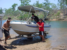
Borroloola Estuary Fishing Tours
Lot 539 Anyula St, Borroloola Tel: +61 (0) 8 89 758 716 |
 |
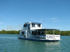
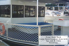
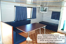
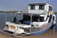
| Borroloola House Boat Hire 5 Riverside Drive, Borroloola Tel: +61 (0) 8 89 759 760 Fax: +61 (0) 8 89 759 772 |
 |
|
Borroloola Events - Borroloola has two main events for the year. The Rodeo, Gymkhana, and Campdraft goes for three days in August every year. Often around the following dates the 20th, 21st and 22nd of August. Locals and visitors from Queensland compete in the 3 day event. The Fishing Classic also attracts many visitors from all over Australia. It is usually held over the Easter Weekend. The event is held at King Ash Bay Boat & Fishing Club. See the website above on King Ash Bay. To confirm dates please contact the community site |
 |
|
NT Luxury Houseboats - Darwin Spectacular Scenery & Wildlife Fully Air-conditioned Kitchen Spa on Foredeck DVD & Movie Library Great Fishing Sun Deck BBQ -We will operate all year weather permitting. Darwin Harbour Darwin Harbour Prices on Application King Ash BayJune, July & August (last known prices) Per Day: $950 April, May, September & October Per Day: $1200 Tender Hire Per Day: $200 Grocery Stocking Available on Request All prices include GST We will operate all year weather permitting. www: Houseboats
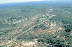
King Ash Bay is located around 50 kilometres past Borroloola on the McArthur River and is a popular fishing spot all year round. The King Ash Bay Boat and Fishing Club is a primary destination for visiting anglers and hosts the annual Borroloola Fishing Classic, a fishing competition that attracts competitors from all over Australia. Theres also a service station, mini-mart, houseboats, accommodation and fishing tours available. The clubhouse is open nightly and serves counter meals at the Groper Bar from 1800 to 2000. Borroloola is a remote fishing community on the McArthur River in the Gulf of Carpentaria. This historic town is considered the gateway to the Gulf region and is famed for its excellent fishing. Borroloola can be accessed via the Carpentaria Highway from Daly Waters in the Northern Territory or on the road through Garawa Aboriginal Land Trust from Queensland. Once a frontier town, Borroloola is now the capital of the Gulf region. Today, the town is still a bit wild and unruly at times, but the people are friendly and easy going. Fishing and camping remain a way of life for locals and travellers chasing barramundi. King Ash Bay, a great fishing spot 50 kilometres from Borroloola, also attracts thousands of visitors each year. The Sir Edward Pellew Group of Islands provides good reef fishing where red emperor, coral trout and parrot fish can be caught. The settlement has two main events every year. The Rodeo, Gymkhana and Campdraft held over three days in August and the Fishing Classic usually held on the Easter long weekend at King Ash Bay. |
|
|
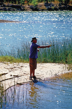
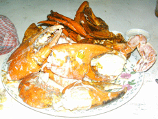
River View Cottage at King Ash Bay King Ash Bay, approximately 40 kilometres past Borroloola, is a mecca for fishermen. Nestled on the banks of the McArthur River, life at King Ash Bay focuses on that king of sportfish, the mighty barramundi. With access to a vast river network, mud crabs crawling through the mangroves, plus reef and sail fishing in the Gulf of Carpentaria, it's a wildlife haven; mind the crocodiles! The magnificent Sir Edward Pellew Island group, just offshore, is yet another fishing paradise. On the off chance your life doesn't entirely revolve around fishing, these islands provide world class oportunities for bird watching and photography. The licensed club house at King Ash Bay Fishing Club provides all the services you'd expect from your local at home. Every Easter they host the Barra Classic, which draws fishers from all over Australia to tackle the wet season runoff. Petrol station, supermarket, bait, spare lures :-) it's all here ready for you. Launch your boat at the purpose built concrete ramp... it's next to the bar, so don't mess up... then moor at your own private jetty right outside your door at River View Cottage. |
|
|
King Ash Bay Fishing Club Welcome to the King Ash Bay Fishing Club, the club is situated on the banks of the McArthur River approx. 52km past the township of Borroloola (see map & road conditions page for directions). A two lane concrete boat ramp gives you access to a huge system of rivers and channels (this area is famous for its Barramundi). Several main rivers lead to the Gulf of Carpentaria which is approx. 30km by river from the King Ash Bay Fishing Club. Offshore you can fish for Mackeral, Tuna and a variety of reef fish in the blue tropical waters of the Sir Edward Pellew group of islands. Maps and tide charts for this area are available from the Mini-Mart. For your convenience there is a Service Station, Mini-Mart, House Boats, Accommodation and Fishing Tours available. The clubhouse is also open nightly from 5 - 9 pm serving
counter meals at the Groper Bar from 6 - 8pm. The Club has
240v power available 24 hours a day and its own water supply
suitable for drinking. Coin operated washing machines are
situated in the main toilet block if needed. For the serious
fisherman the King Ash Bay Fishing Club conducts its annual
Fishing Classic each year on the Easter weekend. This event
is conducted over 2 days and has cash and prizes for all
divisions. |
|
| Road Report Links, Routes & Maps | |
|
Some local, Government & Tourism Association sites to visit. Map Road Conditions and Safety
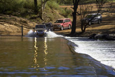
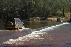
Notes: Year Round Access Borroloola is accessible by road via a sealed highway from Katherine. It is also accessible by Air all year round. The Savannah Way Road between Borroloola and the Queensland Border is closed during the Wet Season (December - March) due to swollen river crossings. The Roper Highway to Mataranka (Nathan River Road section) is also closed to traffic during the wet season months when the river crossings are impassable. |
|
|
Route 1. Notes: Year Round Access Borroloola is accessible by road via a sealed highway from Katherine. It is also accessible by Air all year round. |
|
|
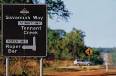
Route 2. The Savannah Way Road between Borroloola and the Queensland Border is closed during the Wet Season (December - March) due to swollen river crossings. The Roper Highway to Mataranka (Nathan River Road section) is also closed to traffic during the wet season months when the river crossings are impassable. Nathan River Road - Roper Bar to Borroloola. We strongly
recommend you buy detailed maps, Linking out:
Map If one leaves the Stuart Highway south of Mataranka, travel on app. 135 km of single lane bitumen before you hit the gravel.For distances we often suggest http://www.exploroz.com The Roper Bar crossing used to be the site of an old Police station , the concrete road across the river (now a concrete causeway) that will get rather slippery. The Roper Bar Store (Phone 08 8975 4636) and associated campground is the last opportunity to fuel up etc before setting off east, then south, to Limmen Bight and Borroloola. It is also here that you turn off the Roper Highway and enter the Nathan River Road. It is here that the road sometimes changes character and looks like no-one has travelled it in a while. The road follows the Roper River for another app. 93 km, with several cleared camping spots and a boat ramp along the way.For distances we often suggest http://www.exploroz.com The Limmen River Fishing Camp is around half way along Nathan River Road. It is about 24 km off the main road and has all the facilities that you would need to have a bush camp. It is still an untapped resource in the Northern Territory, being travellers traffic. Every year the road is graded and again in 2007 there were major enhancements completed to the 'softer' sections. The road into the camp was also graded. Each year the number of caravans utilising this road between Katherine & Borroloola is increasing although most old maps indicate 'no vans'. Four wheel drive is recommended , mainly due to the road clearance. However we've had some late model sedans arrive here with no problems at all. For updates ring the Limmen River Fishing Camp. A tip for locating the turnoff to Limmen River Fishing Camp, you turn off at the cox river crossing ( north side). The Cox river flows into the mighty Limmen River. The Limmen River Fishing Camp is one of those locations where you can enjoy, relax and even experience Territory bush living. Reference to http://www.parksandwildlife.nt.gov.au/parks/find/limmen#.UjbU4EqwqM8 |
|
| Further On - Areas | |
|
MacArthur River Mine McArthur River Mine open pit development From a remote corner of Australia's Northern Territory, McArthur River Mine (MRM) has become one of the world's largest providers of zinc in bulk concentrate form. Our objective is to produce competitive and reliable supplies of zinc bulk concentrate for global markets through a sustainable mining operation. This operation works in partnership with employees, customers,
the community of the local Borroloola region, the Northern
Territory and Australian Governments and all other stakeholders
based on integrity, cooperation, transparency and mutual
value-creation. |
|
|
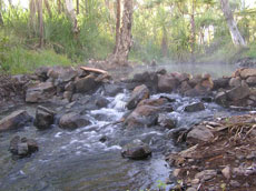
Lorella Springs Caravan Park
Northern Territory
Located 15 degrees south of the equator, in one of the remotest and most isolated areas of Australia or even planet Earth, we offer a superb retreat experience of an outstanding natural environment. Lorella Springs Tourist Park is part of Lorella Springs Station, a virtually untouched one million acre cattle station located 180 kilometres west of Borroloola, off the Savannah Way. This huge, remote property offers a retreat of solitude and serenity. With over 20 kilometres of coastline, waterways, wetlands and swamps, spectacular rock formations and mountain ranges, ancient chasms and gorges, the environment is teaming with wildlife including bird-life, crocodiles, wild buffalo, brumbies and dingoes. The campground at the station homestead includes safari tent style accommodation and acres of shady, grassy camp sites beside a natural hot water thermal spring, which is perfect for visitors to relax in. The historical homestead houses a tourist information centre and a great bar. General supplies are available along with showers, toilets, a camp kitchen, fire places and wood piles. The Rosie Fishing Campground is also located on the property which offers diverse fishing opportunities ranging from pandanus-lined freshwater billabongs, estuarine river and creek through to tropical reef outcrops. This campground has limited facilities, boat ramps, and is accessible by four wheel drive only. Lorella also caters for specialised interest touring - fishing, four-wheel driving, survival, bird watching, and bush walking. THINGS TO DO Daytrip - FREE - Come visit us and enjoy relaxing in the "Magic" Natural Thermal Pool. Visit some of our natural attractions.
Come visit us and enjoy relaxing in the "Magic" Healing Natural Thermal Pool. Visit some of our many natural attractions. GETTING THERE: Much of Lorella and its coastline is untouched and approx 80 km or more from the homestead and can only be reach by EXTREME 4WD Driving by HIGHLY PREPARED and EXPERIENCED DRIVERS or by escorted tour. Destinations, times, adventures and prices by arrangement Photo's are courtesy of www.lorellasprings.com a memorable experience in the outback |
|
|
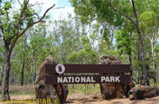
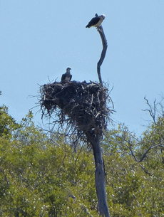
Major National Parks in the Region Barranyi ( North Island) National Park - This 541ha national park lies within the Sir Edward Pellew group of Islands approximately 30km from the mouth of the McArthur River and the Carrington Channel entrances ( refer to marine chart AUST 305). The Island is the traditional home of the Yanyuwa Aboriginal people. The park plays an important role in the preservation and protection of their culture and tradition. Travellers wishing to visit the park should contact the
NT Parks and Wildlife staff at the Borroloola Office on |
 |
|
Major National Parks in the Region Caranbirini Nature Reserve - Located 37km from Borroloola on the Carpentaria Highway Carranbirini offers the visitor easy walks through sandstone towers on a path which overlooks a billabong and looks across the escarpment country of the Gulf Region. There is no camping. It is restricted to day use only. For more information contact the NT Parks and Wildlife
staff at the Borroloola Office on |
|
|
Major National Parks in the Region Limmen Bight National Park ( Proposed ) - Located on the Roper River road180 km from Borroloola on the Lost City Access Track. Contact the NT Parks and Wildlife staff at the Borroloola
Office on |
|
|
Cape Crawford Crawford features the famous Heartbreak Hotel and lies at the intersection between the Carpentaria and the Tableland highways. The gateway to the Gulf Country, it is worth stopping for a while and taking a breathtaking scenic flight over the Lost city in the Abner Rangers.
|
|
|
Cape Crawford is a remote stop, home of the famous Heartbreak Hotel, at the junction of the Carpentaria and Tablelands Highway. Despite the first part of its name, Cape Crawford is situated approximately 120 kilometres from the ocean and is so named because it is situated at the northern extremity or cape of the Abner Ranges, which were first discovered by drover Lindsay Crawford in 1880. The Abner Ranges are home to an impressive formation known as the Lost City. The Lost City covers an area of about 8 square kilometres and is dotted with towering sandstone formations. These natural pillars remind many observers of skyscrapers, and are well worth a visit. Helicopter flights which land in the Lost City give access to four wheel drive tours through the sandstone formations. (Copyright & Courtesy of Toursim NT) |
|
|
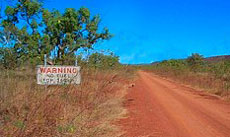
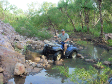
Pungalina Station - Caravan and Camping Accommodation Pungalina Station, situated in Australia's Northern Territory Gulf, is 500,000 acres of remote outback wilderness with a comfortable eco safari camp for 12 people next to a natural thermal spring. Designed for 'flyins' or four wheel drive access, it is fully catered and licensed. Seven day air tour charters from Melbourne across Australia to Pungalina can be arranged with special discounts for groups of 6 to 8 clients. Activities include barramundi fishing, canoeing, bush walking, bird watching, swimming, limestone caving, gorge exploring and more Camp Ground Safari Camp The site provides a safe and healthy water supply and the springs are perfect for that early morning or afternoon swim. Guests stay in spacious, fully insect screened individual or twin share tents, in comfortable beds with doonas and permanent lighting. Although many meals are served outside in the shade, a central marquee accommodates the dining room tent. All meals are prepared by the safari camp chef. Hot showers and flushing toilets are available. Safari camp tents can accommodate overnight stays as well as extended stays so please note, the rate supplied reflects daily rates only. Rate does not include air transfer and prior bookings are essential. Getting there by road: Pungalina is a very remote wilderness even by outback Australian standards. Access is via four wheel drive only, and then only during the dry season. The drive from Mt Isa will take at least 13 hours. Follow the Wollogorang to Borroloola Rd ( Savannah Hgwy) going west past Hells Gate Roadhouse. 26 Kms past Wollogorang is Red Bank Copper Mine. Then another 14 kms to the entrance to Pungalina cattle station. This turn off is on the right with a round white "Pungalina " sign and it is a 65 km driveway to the homestead. This is 4WD and includes many creek crossings, sand areas and rugged sections. Gate entrance co-ordinates on the Savannah Way are : S 17° 9.75' E 137° 38.90' http://www.pungalinasafaris.com.au/ this used to be the web iste but appears down now. Permission must be obtained prior to entry from Owen Davies at Pungalina on (08) 8975-8951. The drive from the Savannah Hgwy is 65 kms and could take 2 hours. Campers are requested to stay in the safari camp accommodation. Leave camper vans etc at Hells Gate prior to entry and/or make other arrangements with Owen Davies. Important: We suggest ring them now- before you depart for up todate information. As this is a remote spot you must make sure there is room for you and you have the correct information as the as this page is a general guidleine. |
|
|
Bauhinia Downs Station Another 45km south from the Lorella turn off is the turn off 24km in to what is probably the Northern Territory's finest springs. There are both hot springs, cascading down from a giant cleft in the ancient rock wall through a spectacular series of rock pools, and cold springs mixing into a large thermal lagoon. The whole effect is quite awesome and really has to be seen to be believed! This area is not open to the public but Sandra at Cape Crawford Tourism runs very popular tours into the springs at Bauhinia from near here; her helicopter tours are a great way to experience this magnificent location. Flights might at first seem a bit expensive but overall it's a cost effective way to view and photograph these spectacular places; it's not a cheap place to park a helicopter on the off-chance. Ground tours can also be arranged into both Bauhinia and the Lost City during the dry season. For further details call into Cape Crawford Tourism on the Roper Bar Road, follow the signs, or phone Sandra Schleter on (08) 8975 9611. Click here to go to her website. Cape Crawford Tourism is located 6 kms up the Roper Bar Road, 2 kms west of Cape Crawford in the Northern Territory. It is 110 kilometres south-west of Borroloola and just north of the Cape Crawford Roadhouse. Just follow the signs if you have not made a booking. If the helicopter is not at the pad opposite Heartbreak Hotel or at the pad on Leila Creek Station, the tour is in operation and we will return within 2 hours. Or Bookings essential contact Mr Harry Lansen through Mabunji. The property used to have hunting tours for buffalo, and barramundi fishing available. An airstrip is close to the community and the hot springs. This area is regarded by some people as the best gorge and hot water springs anywhere in the top end of Australia. The area is still very undeveloped and closed completely during the wet. Bauhinia Downs is some 120 km south west of Borroloola and has beautiful pristine waterfalls, gorge, hot and cold springs. It also supports a variety of wildlife such as salt water and fresh water crocodiles, bat colony, gorgeous butterfly colonies, bush turkey, brolgas and kangaroos just to name a few, there is also a large variety of birds. Bauhinia Downs offers camping with facilities at a fee. Season: Starting in April, depending on the wet season, going through to the end of October. Eventually more tourists will travel the Northern section of Australia in the wet season enabling us to operate 12 months of the year. |
|
|
Mabunji Outstations Mabunji services 26 Outstations Homelands, providing services such as transport, housing, water, power (electricity, solar). Mabunji is located in the main town of Borroloola and employs over 300 Indigenous people on a CDEP Government funded scheme. The centre is also responsible for a lot of town based facilities and hosts the Community Radio Station. |
|
|
Please Note: Please note these links are supplied only as a link for information, which our company has no affiliation wth these links. Please note our company is not responsible for the contents of any link sites and is offered in good faith only. We strongly recommend you verify all information and comments supplied here and use it only as a general indication and guideline. Planning to travel from Katherine to Borroloola to Hell's Gate to Lawn Hill. |
|
 |


-

4wd Rooftop Tent Camper
4wd Camper hire from Darwin -
Campervan hire Darwin
Travel in comfort in a campervan -